You've got twelve days, four states, and a route that looks great on a screen until you realise you've planned 480 miles for a Tuesday that starts with a cold front coming down from the Rockies. Mapping a multi-state motorcycle road trip is not the same as typing "Texas to Utah" into a phone and hitting go. The tools most riders use weren't built for motorcycles, and the tools built for motorcycles don't always know where the petrol stations are.
I'll walk you through how I actually build these routes now, including the parts I got wrong on a 2,300-mile run through the Southwest that taught me more than any tutorial.
Key takeaways
- Google Maps has no native motorcycle mode — it will happily send you down gravel and across toll roads you didn't budget for
- Break the trip into day stages of 250–350 miles, not into "states traversed"
- Plan fuel stops every 100–130 miles on rural legs, more often in the desert or mountains
- Helmet laws, lane-splitting rules, and toll systems change at every state line — check each one
- A route file (GPX) is the only thing that survives a stretch of no signal in Nevada
How to map a multi-state motorcycle road trip without losing your mind
Here's the sequence I use now, in order. It took me a few bad trips to settle on it.
Start with the shape, not the road
Before I touch any app, I decide three things on paper: total distance, number of riding days, and one hard constraint per day (a mountain pass I want to hit, a town where a friend lives, a ferry timetable). Everything else is negotiable.
The biggest mistake I made early on: I planned the road first and the days second. That meant a 620-mile day across Kansas turned into a 9-hour slog in crosswinds with two hours of daylight lost to a fuel detour. Now the shape comes first, and the road bends around it.
Build the daily stages
A realistic planning rule for most riders is 250–350 miles per day on secondary roads, and 400–500 miles if you're mostly on interstates and can tolerate it. Anything over 500 miles a day stops being a road trip and becomes a commute with a scenic backdrop.
- Day 1: shorter than you think — 200–250 miles, because you're still loading the bike and getting your head in
- Middle days: the meat of the trip, 280–350 miles on backroads
- Penultimate day: taper back to 250, because fatigue compounds quietly
- Last day: whatever gets you home before dark
I never plan a day stage without a backup town mid-way. If the weather turns, you need an exit.
Layer the fuel stops
This is where most route planners fail you. A car can stretch 400 miles on a tank; a bike with a 3.5-gallon tank at highway speeds is looking at 140 miles before reserve. On rural legs through Nevada, Wyoming, or eastern Oregon, fuel stations can be 80 miles apart.
My rule: plan a fuel stop every 100–130 miles in rural areas, and every 80 miles once I'm above 7,000 feet or into desert heat. I mark them as waypoints in the app so the route follows them.
Does Google Maps have a motorcycle route planner?
No. Google Maps has no motorcycle profile. Its routing engine treats you like a car, which means it will route you down unpaved farm roads if it thinks that saves time, and it will route you onto interstates you probably wanted to avoid. There's no setting for "avoid highways" plus "avoid dirt" plus "avoid unpaved" as a combined profile.
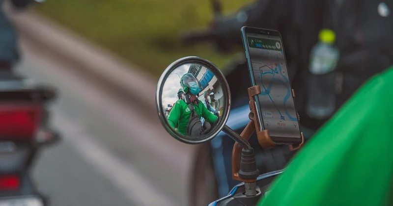
What it does have: excellent traffic data, offline maps, and multi-stop waypoint support. So I use it, but only for the last-mile bit — getting from a backroad to a specific hotel — and never as the primary planner.
What to use instead
For actual motorcycle routing, I lean on two tools: Kurviger (genuinely built for motorbikes, with a "curvy road" slider that produces routes that are actually enjoyable) and calimoto (good for generating a loop from a start point when I don't care where I go). For multi-state trips, MyRouteApp is what I trust most, because it lets me draw the exact line I want and export it as a GPX file that my GPS unit reads without changing anything.
Free options? OpenStreetMap-based planners like GraphHopper and Brouter will do motorcycle routing for nothing. They're uglier than the paid apps but the routing logic is solid.
What is the 12 second rule for motorcycles?
This one comes from advanced rider training. The idea: scan roughly 12 seconds ahead of your current position at your current speed — that's the distance you should be reading the road for hazards, not the 3–4 seconds most drivers use.

At 60 mph, 12 seconds is about 1,000 feet ahead. That's the margin you need to process a corner, a deer at the verge, or a truck pulling out. On multi-state trips it matters even more because the road surface and the hazards change state to state — a perfectly maintained road in one state becomes a potholed mess at the next border.
I don't treat it as a hard number. I treat it as a reminder that on unfamiliar roads I should be reading further ahead than feels comfortable.
Is 200 miles a long motorcycle ride?
Depends on the road and the bike. On backroads with 45 mph averages and a couple of stops, 200 miles is roughly 4.5–5.5 hours in the saddle. On interstates at 75 mph with one fuel stop, it's closer to 3 hours. That's a long ride for a beginner and a short one for a veteran.
My rule of thumb: under 200 miles is a day out. Over 400 is a proper day's ride. Between 200 and 350 is the sweet spot for a multi-day trip — long enough to make progress, short enough to arrive with energy for the evening.
200 miles on a twisty mountain road will exhaust you faster than 350 miles on a straight highway. The number matters less than the road.
The state-by-state checks nobody mentions
This is the part I wish someone had told me before my first cross-state trip. State lines are where the rules change.
| Check | Why it matters | How to handle it |
|---|---|---|
| Helmet law | Some states require helmets for all riders; others allow adults to ride helmet-free under conditions | Check each state on your route and plan one rule set for the whole trip |
| Lane splitting | Only a handful of states permit it, and rules differ | Assume it's illegal unless you've confirmed otherwise for that state |
| Tolls | Some systems bill by plate, some need a transponder, some have no cash option | Carry a compatible transponder or plan cash-optional routes |
| Registration & insurance | Your home state covers you, but injury limits vary | Confirm your policy limits before crossing into a no-fault state |
| Gravel and construction | Seasonal road work on mountain passes | Check state DOT websites a week before departure |
The border town strategy
I plan every state crossing to land in a town, not on a two-lane road in the middle of nowhere. Why? Because if something goes wrong — a broken lever, a flat, a missing document — being near a town with a garage changes the trip from a delay to a disaster.
Put everything into a route file
Screen-based planning looks fine until you're in a canyon in Utah with no signal. The fix: export your finished route as a GPX file and load it onto your GPS unit or phone in offline mode. I keep three files per trip: the planned route, a shortened version (skipping the optional scenic detour) and a "get to the nearest town" fallback.
Once you've done this a few times, the sequence becomes muscle memory: shape, stages, fuel, state rules, file. Everything else is weather and luck.
The best trips I've done weren't the ones with the cleanest spreadsheets. They were the ones where I'd left enough slack that a wrong turn into a tiny town with a diner turned into the story I still tell. Plan the frame tightly, then leave room for the trip to surprise you.