You are standing at a gas pump in Mexican Hat, Utah, watching the numbers climb past sixty dollars, and the attendant is telling you the next station is 110 miles south. No towns. No houses. Just rock, sky, and one road. That moment, the one where you do the math on your tank versus the map, is what separates a desert highway ride from a desert highway mistake.
The American Southwest has the highest concentration of scenic desert roads anywhere in the United States, and most guides give you a pretty list with no logistical backbone. I have driven these routes repeatedly, in summer heat, in spring wind, at dawn when the light turns the sandstone the color of a bruised peach, and I have made almost every mistake on offer: running out of water, misjudging a "short" detour, driving a stretch of Route 66 with a cracked windshield and no cell signal. What follows is the practical version.
Key Takeaways
- The Southwest's best desert rides are two-lane roads, not interstates. Monument Valley's approach and Utah's Highway 12 outrank anything you can drive at 80 mph.
- Fuel planning matters more than scenery planning. Gaps of 100+ miles between stations are routine on the Navajo Nation and along Route 66.
- Late spring and early autumn are the sweet spots. Summer afternoons routinely push past 100°F on the lower desert floor.
- Cell coverage drops out for long stretches. Download offline maps before you leave the last town.
- Flash floods and high-altitude snow close roads seasonally, sometimes with no warning at the trailhead.
Best desert highway rides: what actually earns the detour
A road qualifies for me when it does something a photograph cannot. It has to change your sense of scale. Plenty of scenic byways deliver a nice view from a pullout; the routes below rearrange your head.
Monument Valley and the approach from Kayenta
Coming south on US-163 out of Kayenta, Arizona, the buttes arrive slowly—first as a smudge on the horizon, then suddenly huge and close and impossible. This is the most photographed stretch of desert in the country, and it still works in person. The 17-mile dirt loop inside Monument Valley Navajo Tribal Park is a separate thing entirely: rutted, slow, deeply worth it if your vehicle has clearance. I once watched a sedan bottom out on the first steep descent within fifty yards of the entrance booth. Do not take a low-clearance car on that loop.
Utah's Highway 12
If I had to defend one road as the finest desert drive in America, it is this one, and I will argue it at length. Highway 12 runs roughly 120 miles between Torrey and Bryce Junction, climbing over Boulder Mountain at over 9,000 feet before dropping into slickrock canyons. You get alpine forest and red desert in the same afternoon. The Hogsback, a narrow ridge with drops on both sides, is the section that makes passengers go quiet.
Route 66, Seligman to Kingman
The old Mother Road's best surviving Arizona stretch is not a museum piece. Seligman still has the barber shop that inspired Radiator Springs, and the road lopes west through Peach Springs and Valentine before hitting Kingman. Roughly 90 miles of genuine two-lane Americana, and you will have it almost to yourself on a weekday morning. Don't expect services at regular intervals—fill up in Seligman.
What are some of the best road trips in the southwest USA?
The strongest multi-day desert trip is a loop out of Las Vegas that threads Valley of Fire, Zion, and the Monument Valley approach across four to five days. It gives you volcanic rock, sandstone monoliths, and the Navajo Nation in one continuous line without doubling back.
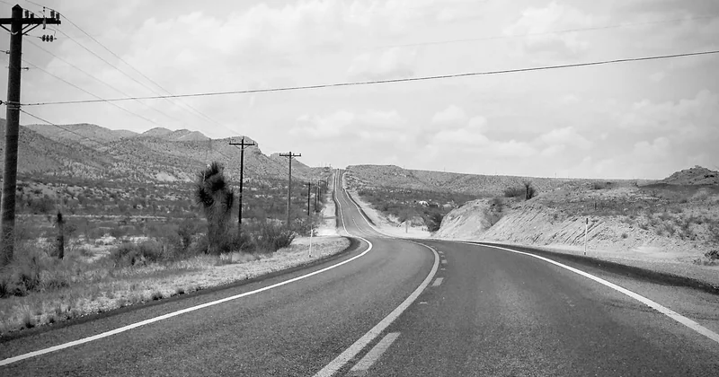
My second recommendation is the less obvious one: Tucson to Silver City, New Mexico, via I-10 and NM-80. It runs through the Sonoran Desert, past the Chiricahua Mountains, and into old mining country. Far fewer people, and I found the silence of that drive more striking than the crowds at the famous parks.
What is the most famous desert road in the USA?
Route 66 holds the cultural title, and the stretch near Seligman is where the legend still feels tangible. But if fame means the road people instantly picture when they think "desert," it is US-163 through Monument Valley. That straight shot with the buttes rising from the mesa floor is the image on the postcard, the film backdrop, the reason people plan whole vacations around one photograph.
What are the top 5 scenic drives in the US?
Any honest ranking is partly opinion, so here is mine, weighted toward desert and mountain West:
- Utah Highway 12 — alpine-to-canyon transitions, Hogsback ridge.
- Going-to-the-Sun Road, Montana — not desert, but the engineering alone earns it.
- US-163, Monument Valley — the single most iconic desert view in the country.
- Blue Ridge Parkway, Virginia and North Carolina — long, slow, ridgeline driving.
- Pacific Coast Highway, California — a different genre entirely, but it belongs.
Notice the desert entries are short. You do not need a thousand miles to have a great drive.
Which 42-mile scenic drive is considered the most beautiful?
Cades Cove Loop Road in Great Smoky Mountains National Park is the 11-mile loop most often named, but the 42-mile figure you are likely thinking of is the Badlands Loop in South Dakota—badlands, not desert, though the landscape reads as barren as any of them. For a desert equivalent at that length, the 44-mile stretch of Highway 12 between Boulder and Escalante captures a similar sense of isolation and scale, and in my experience it delivers more drama per mile than almost anywhere out there.
The logistics no one puts in the pretty list
Fuel, water, and the 100-mile gap
I keep a simple rule: fill up whenever you see a pump if the next town is more than 80 miles away, and carry at least a gallon of water per person. On the Navajo Nation, stations are genuinely sparse. On Route 66 west of Seligman, you can drive an hour before the next sign of life.
Seasonal closures and flash floods
Highway 12 closes in winter storms at elevation. Slot canyon access across the region shuts down without warning when storms hit upstream—the flood can arrive under clear skies where you are standing. Check conditions the morning you drive, not a week before.
| Route | Length | Best season | Fuel gap to plan for |
|---|---|---|---|
| US-163, Monument Valley | ~45 mi approach | Spring, autumn | ~110 mi Kayenta to Bluff |
| Utah Highway 12 | ~120 mi | Late spring, early autumn | ~40 mi, but elevation snow closes it |
| Route 66, Seligman–Kingman | ~90 mi | Spring, autumn | Fill in Seligman every time |
One last thing before you drive
The desert rewards preparation and punishes assumption. The roads here will give you something the interstate never can: hours where the dashboard clock and the horizon are the only things moving, and the landscape simply refuses to be small. Take the two-lane. Bring the water. And leave the rental sedan at the trailhead when the map says dirt.